May 17, 1998 - Grand Canyon - 9 Days
Tanner, Beamer, Little Colorado River and Escalante Route
<Click on the thumbnail images to enlarge the pictures>
Hike day (Sunday) started with a 3:30 AM wakeup call at the Yavapai Lodge on
the south rim of the Grand Canyon. Kathy and I had purchased some boiled eggs at
Babbit's general Store the night before, and we had these for breakfast in our
room.  We were checked out at 4:20 and at the Tanner
Trailhead
at Lipan Point starting our hike at 5:05 AM. The elevation at the rim is 7400
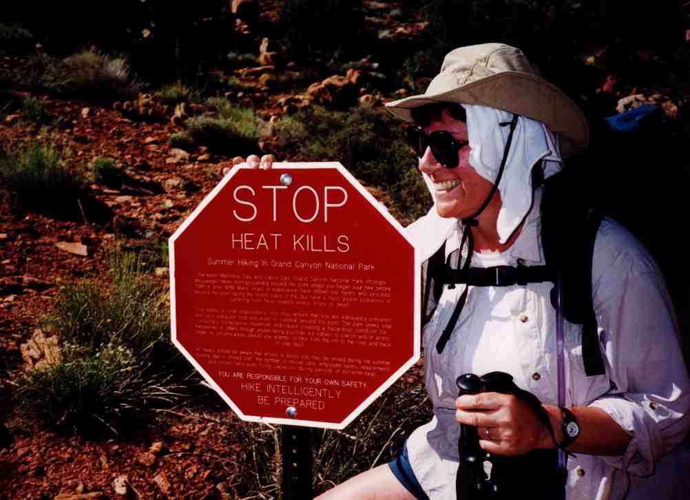
feet and the river is around 2600 feet. It can be unmercifully hot in the
canyon in May, and we wanted to get a few miles in before the sun started We were checked out at 4:20 and at the Tanner
Trailhead
at Lipan Point starting our hike at 5:05 AM. The elevation at the rim is 7400
feet and the river is around 2600 feet. It can be unmercifully hot in the
canyon in May, and we wanted to get a few miles in before the sun started beating on us. It took only a couple of hours to reach the 75 Mile Saddle, 1700
feet below the rim, where we took a break, had a snack and admired the nice view
down 75 Mile Canyon.
beating on us. It took only a couple of hours to reach the 75 Mile Saddle, 1700
feet below the rim, where we took a break, had a snack and admired the nice view
down 75 Mile Canyon.
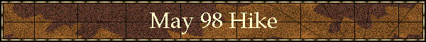
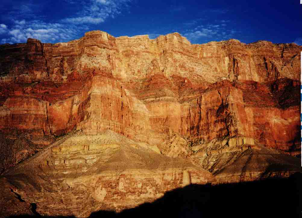
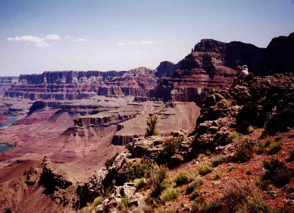
Contouring around Escalante and Cardenas buttes is an easy but long walk. We 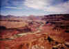 stashed
6 liters of water at Cardenas for the return trip. Just above the redwall, there
is one of the nicest view campsites we have yet seen in the canyon. From that
overlook, we had a panoramic view of the Colorado River from Unkar to the Little
Colorado Confluence, our goals for later that week. stashed
6 liters of water at Cardenas for the return trip. Just above the redwall, there
is one of the nicest view campsites we have yet seen in the canyon. From that
overlook, we had a panoramic view of the Colorado River from Unkar to the Little
Colorado Confluence, our goals for later that week.
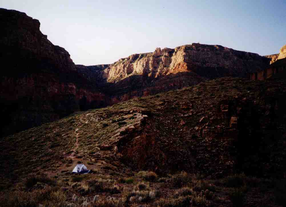
We continued on and made camp just below the redwall shortly after noon. It
was really getting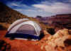 hot by this time, so we just lounged around under the shade of some bushes.
Around 3:30, we checked our food bags and found, to our delight, that the beer
we had brought was still cold. At 5 pounds a six pack, we thought it our duty
and obligation to lighten our loads by a couple of pounds.....
hot by this time, so we just lounged around under the shade of some bushes.
Around 3:30, we checked our food bags and found, to our delight, that the beer
we had brought was still cold. At 5 pounds a six pack, we thought it our duty
and obligation to lighten our loads by a couple of pounds.....
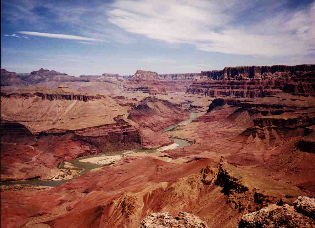
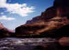
Day 2 (Monday) - Waking up at 5, we broke camp and hit the trail by 6:20.
Along the way we stopped, boiled up some eggs, and made coffee. We were at
the Colorado River by 8:40 where 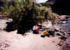 we
gave our sore toes a brief rest before continuing on to Comanche Creek where we
pumped water and had lunch. It was hot, so we rested in the shade by the river
for a few hours. Around 3:30, we took advantage of some spotty clouds blocking
the sun and headed out for Palisades Creek. We spent the evening watching bats
and the stars, and had a late dinner by flashlight. we
gave our sore toes a brief rest before continuing on to Comanche Creek where we
pumped water and had lunch. It was hot, so we rested in the shade by the river
for a few hours. Around 3:30, we took advantage of some spotty clouds blocking
the sun and headed out for Palisades Creek. We spent the evening watching bats
and the stars, and had a late dinner by flashlight.
Day 3 (Tuesday) was a rest day, and we explored the immediate area. There is
an old mine and the remnants of a miner's cabin not far from our campsite, and
Palisades Creek Canyon provided a nice easy hike on gravel. Returning to camp for
lunch, we found that our egg holder had opened and 2 of our 4 remaining eggs had
smashed from banging around in the current of the Colorado River. (The Colorado
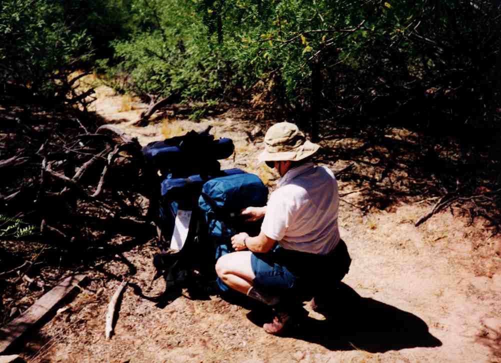
River is very cold and makes a good refrigerator.) We ate the remaining two eggs for lunch, and hung around the campsite for the remainder of the hot
afternoon. Before going to sleep for the night, we loaded our day packs for the 12
mile round trip hike to the Little Colorado River the next day. We had attempted
this trip the previous September but were not successful because we were unable
to hike any great distance in the 105 degree weather.
eggs for lunch, and hung around the campsite for the remainder of the hot
afternoon. Before going to sleep for the night, we loaded our day packs for the 12
mile round trip hike to the Little Colorado River the next day. We had attempted
this trip the previous September but were not successful because we were unable
to hike any great distance in the 105 degree weather.
 Day
4 (Wednesday) found us on the trail at 6:15 heading out for the confluence of
the Little Colorado River. The trail immediately goes high and stays about 500 Day
4 (Wednesday) found us on the trail at 6:15 heading out for the confluence of
the Little Colorado River. The trail immediately goes high and stays about 500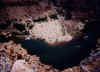 feet above the river the entire way. There was a river trip with two large
motorized rafts across the river at Carbon Creek. We were looking down
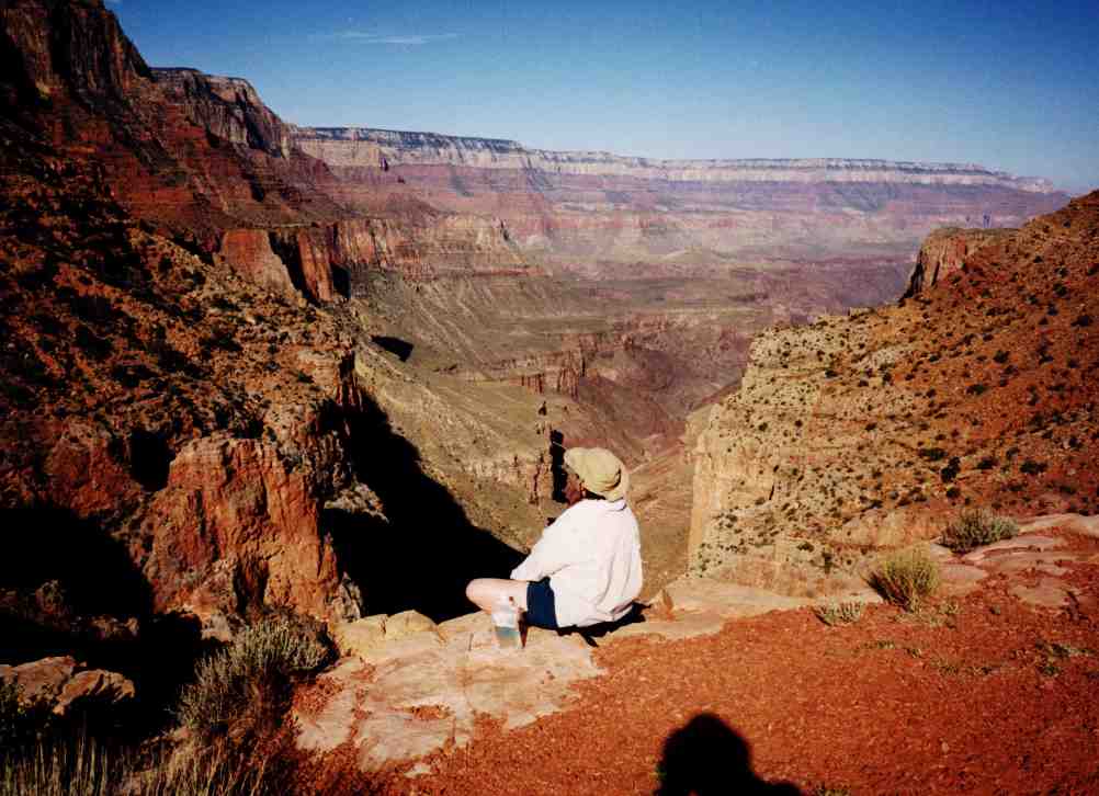
at their camp as we hiked by. We made the Little Colorado at 10:45, and found
that the river was running brown. When there is rain or runoff in the desert,
the mud and silt washes down the Little Colorado
and dumps into the green Colorado River. The water from the two rivers does not
mix together for the first mile or so, and makes an interesting sight with one
side of the river green
feet above the river the entire way. There was a river trip with two large
motorized rafts across the river at Carbon Creek. We were looking down
at their camp as we hiked by. We made the Little Colorado at 10:45, and found
that the river was running brown. When there is rain or runoff in the desert,
the mud and silt washes down the Little Colorado
and dumps into the green Colorado River. The water from the two rivers does not
mix together for the first mile or so, and makes an interesting sight with one
side of the river green  and clear, and the other side brown and cloudy. When
the desert is dry and there is no runoff, the Little Colorado River runs a
beautiful azure blue from the calcium carbonate laden springs that feed it. and clear, and the other side brown and cloudy. When
the desert is dry and there is no runoff, the Little Colorado River runs a
beautiful azure blue from the calcium carbonate laden springs that feed it.
While walking along the shore at the Little Colorado, I almost backed up into
a rattlesnake. It was rattling like crazy, but I thought it was an insect making
the noise. It calmed down when I gave it some space, and we both went on our
separate ways without a conflict. We also ran into a young woman who had been
hiking alone for the past month. She had started at Elves Chasm at river mile
116 and was now at the Little Colorado at river mile 61. She was trying to hitch
a ride across the Colorado River on one of the rafting trips to continue her
hike on to the Nankoweap trail at river mile 52.
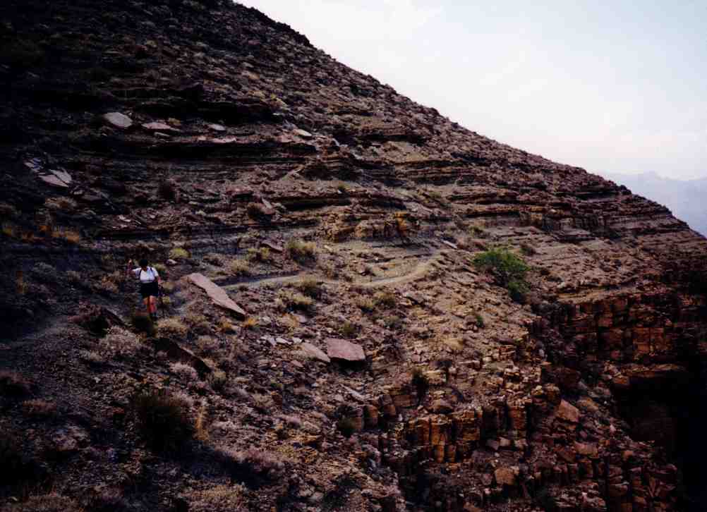
The hike back was into strong winds and some on and off drizzly rain. Not the best
conditions for contouring along the side of a cliff for 6 miles. There are a
couple of exposed areas where we found ourselves right on the edge of a 500 foot
drop with a trail slightly wider than our boots. If we were to do that trail
again, we would search for a higher route away from the cliffs. We were back at
camp at 6:30 and had a rainy evening. The skies cleared at midnight, and the
good weather returned.
Day 5 (Thursday) started leisurely with another exploration of the miner's
cabin and the mine
area. We broke camp and started out for the Tanner delta at 10:15. Arriving at
noon, we had lunch and spent the hot afternoon keeping out of the sun and  fighting
off the attack squirrels trying to get into our packs. In the cooler late
afternoon, we headed out for the Cardenas area, reaching the Cardenas Creek area
around 5:45. We searched for quite a while to locate a suitable camping area,
and finally found a good site with the sun already fighting
off the attack squirrels trying to get into our packs. In the cooler late
afternoon, we headed out for the Cardenas area, reaching the Cardenas Creek area
around 5:45. We searched for quite a while to locate a suitable camping area,
and finally found a good site with the sun already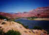 setting over the rim. We ended up camping on the top of a dune about 40-50 feet
above the river, with a great 360 degree view of the canyon.
setting over the rim. We ended up camping on the top of a dune about 40-50 feet
above the river, with a great 360 degree view of the canyon.
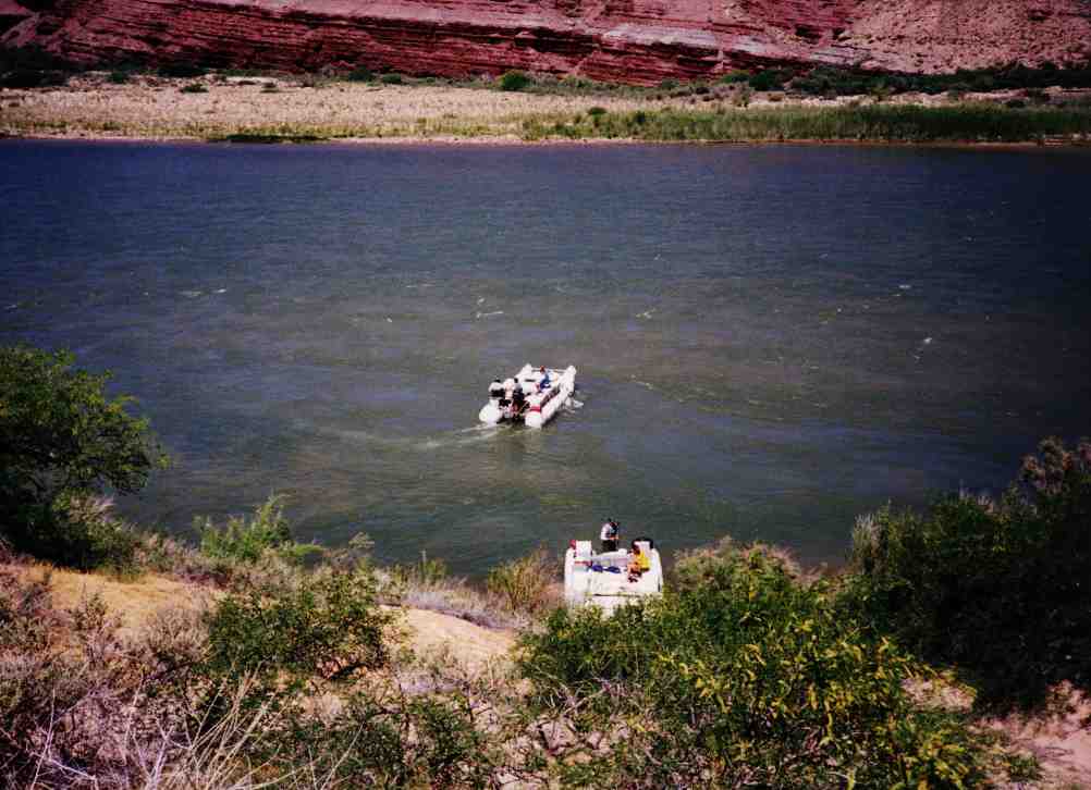
Day 6 (Friday) - We hung around camp and by the ledges at the river for most
of the day. Shortly after 11:00, two small motorized National Park Service rafts
came around the bend 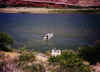 in
the river. They were almost by us when they spotted our tent, and pulled over
just below our camp. Two park rangers walked up the hill and inspected our camp
and our permit very carefully. Everything was in order, and they continued on
their way after chatting with us for a short time. Around 4 o'clock, we hiked up
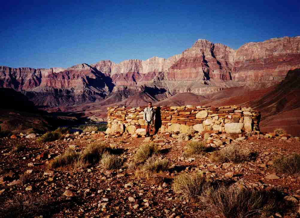
to the overlook around 500 feet above Unkar rapids. Three kayaks came through
the rapids as we were looking over the cliff. They looked like toys going
through the white water and waves that towered over them. A quarter mile or so
off the trail we found an Anasazi Indian in
the river. They were almost by us when they spotted our tent, and pulled over
just below our camp. Two park rangers walked up the hill and inspected our camp
and our permit very carefully. Everything was in order, and they continued on
their way after chatting with us for a short time. Around 4 o'clock, we hiked up
to the overlook around 500 feet above Unkar rapids. Three kayaks came through
the rapids as we were looking over the cliff. They looked like toys going
through the white water and waves that towered over them. A quarter mile or so
off the trail we found an Anasazi Indian ruin made of stones and mud. The Anasazi disappeared from the canyon around the
year 1300, so this ruin was at least 700 years old, but still in excellent condition.
Things deteriorate very slowly in the arid desert conditions of the inner
canyon. Across the Unkar rapids was a delta with evidence of more Anasazi ruins
that we could see from the overlook.
ruin made of stones and mud. The Anasazi disappeared from the canyon around the
year 1300, so this ruin was at least 700 years old, but still in excellent condition.
Things deteriorate very slowly in the arid desert conditions of the inner
canyon. Across the Unkar rapids was a delta with evidence of more Anasazi ruins
that we could see from the overlook.
Day 7 (Saturday) - The morning was spent at the river washing clothes and
ourselves. It was very relaxing in the shade under the ledges by the river. We
could easily spend a week or so in this  one
spot. At 1 o'clock we went back to camp, had lunch, and packed up for the start
of our hike out. We left at 3:00 and stopped at Tanner rapids to pump water and cool one
spot. At 1 o'clock we went back to camp, had lunch, and packed up for the start
of our hike out. We left at 3:00 and stopped at Tanner rapids to pump water and cool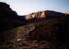 off before heading up the Tanner trail. As the sun was going down, we set up
camp along the trail at 4200 feet elevation, had dinner, and went to sleep.
off before heading up the Tanner trail. As the sun was going down, we set up
camp along the trail at 4200 feet elevation, had dinner, and went to sleep.
Day
8 (Sunday) we slept late, and continued our hike at 8:10, making the base of the
redwall at 10:00. We reached the top of the redwall at 10:45, and ran into two
day hikers on their way down. We 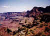 cautioned
them on going too much further, knowing
how hot is was at river level and being concerned that they cautioned
them on going too much further, knowing
how hot is was at river level and being concerned that they could not complete the 20+ mile round trip from rim to river to rim in one day. They
ignored us, of course, and continued on their way. The river looks so close at
that point, but it is very deceiving. We hung out a few hours at Cardenas Butte
and picked up
our stash of water. We continued on and set up camp at the 75 Mile Saddle around
4:00, giving what was left of our feet a well deserved rest. At 6:50, the two
day hikers came trudging by trying to make the rim before darkness set in.
could not complete the 20+ mile round trip from rim to river to rim in one day. They
ignored us, of course, and continued on their way. The river looks so close at
that point, but it is very deceiving. We hung out a few hours at Cardenas Butte
and picked up
our stash of water. We continued on and set up camp at the 75 Mile Saddle around
4:00, giving what was left of our feet a well deserved rest. At 6:50, the two
day hikers came trudging by trying to make the rim before darkness set in.  They
looked very tired, and I reminded them that they had only two miles and 1700
vertical feet to go. They
looked very tired, and I reminded them that they had only two miles and 1700
vertical feet to go.
Day 9 (Monday) was our last day in the canyon. We were up at 6, ate
breakfast, but were in no great rush to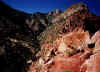 leave. At 8:45, we started out on the
last 2 miles of our trip and reached the rim at 10:50. We drove to Tusayan and
had two 8 ounce sirloin burgers
at the Tusayan Steak House before heading out to Flagstaff for a hot shower and
a real bed. leave. At 8:45, we started out on the
last 2 miles of our trip and reached the rim at 10:50. We drove to Tusayan and
had two 8 ounce sirloin burgers
at the Tusayan Steak House before heading out to Flagstaff for a hot shower and
a real bed.
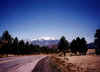
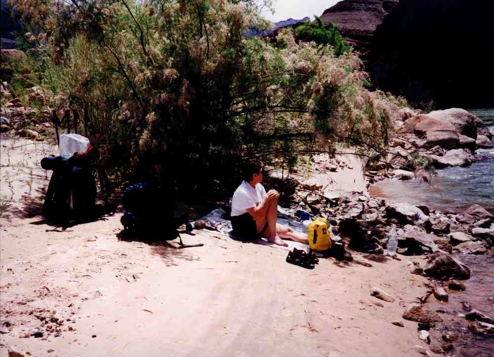
View of Humphreys Peak on the road to Flagstaff.
At 12,633 feet elevation, it is the highest point in Arizona.
|