April 30, 2000 - Grand Canyon - 9 Days
Tanner, Escalante to 75 Mile
<Click on the thumbnail images to enlarge the pictures>
Day 0 (Saturday) - Nice flight from Providence to
Phoenix. Stopped at Busters in Flagstaff for our traditional mushroom Swiss
cheeseburger and mesquite steak sandwich, picked up our fuel and some supplies, and
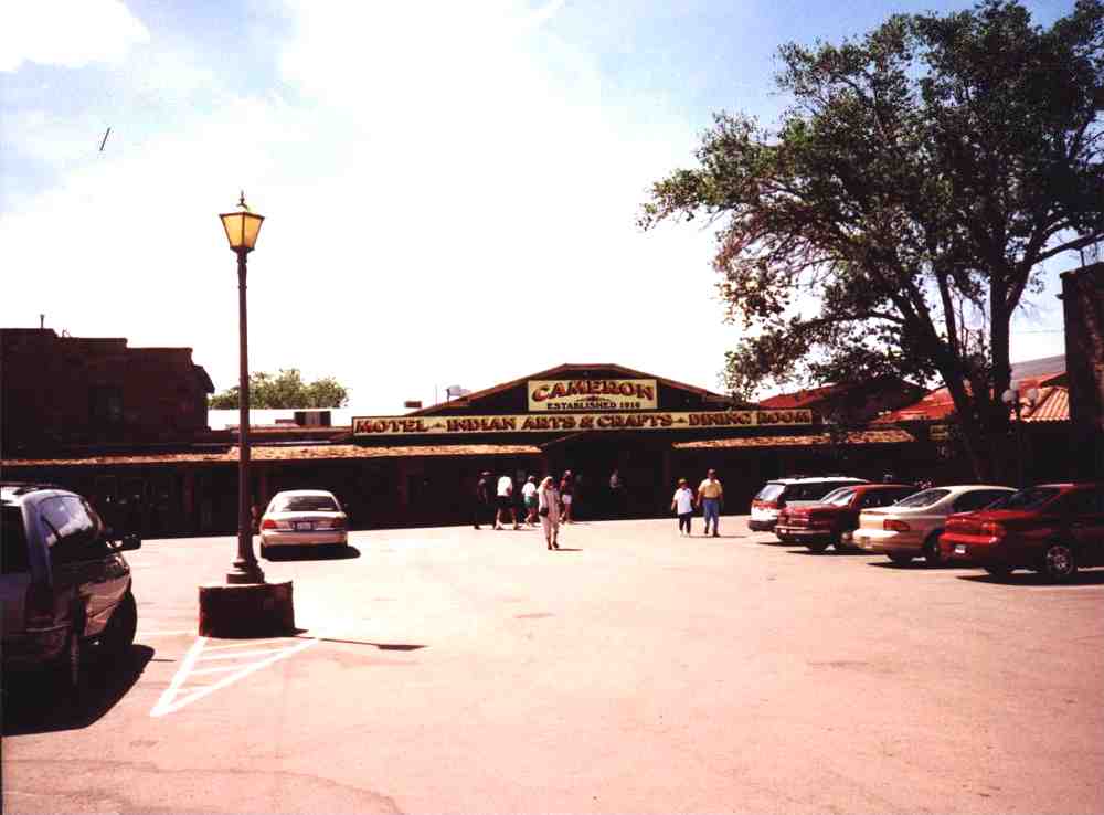
then proceeded to Cameron. We usually
stay at the Yavapai Lodge at South Rim, but this year decided to try the hotel
at the Cameron Trading Post on
the Navajo reservation. The
hotel at Cameron was very nice, and I would
recommend it to anyone. Swiss
cheeseburger and mesquite steak sandwich, picked up our fuel and some supplies, and
then proceeded to Cameron. We usually
stay at the Yavapai Lodge at South Rim, but this year decided to try the hotel
at the Cameron Trading Post on
the Navajo reservation. The
hotel at Cameron was very nice, and I would
recommend it to anyone.
Day 1 (Sunday) - The weather reports had forecast a low of 16
degrees, and our destination for the day was only as far as  the view campsites
above the Redwall, so we were in no rush to get an early start. Had a nice
breakfast of pork cutlets and eggs at the motel restaurant, and left for the
trailhead at 8AM. Reached Lipan Point and the view campsites
above the Redwall, so we were in no rush to get an early start. Had a nice
breakfast of pork cutlets and eggs at the motel restaurant, and left for the
trailhead at 8AM. Reached Lipan Point and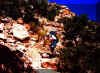 were on the Tanner Trail by 9, with clear skies
and mild temperatures. Enjoyed an early lunch at 75 Mile Saddle, and hung around
there until 12:30. It took about 2 hours to contour Escalante and Cardenas
Buttes, and we reached our camping area at 2:30. We stashed 6 liters of water
just above the Redwall break for a dry camp on the way out, set up our tent, and explored the area. Higher up were on the Tanner Trail by 9, with clear skies
and mild temperatures. Enjoyed an early lunch at 75 Mile Saddle, and hung around
there until 12:30. It took about 2 hours to contour Escalante and Cardenas
Buttes, and we reached our camping area at 2:30. We stashed 6 liters of water
just above the Redwall break for a dry camp on the way out, set up our tent, and explored the area. Higher up
 on Cardenas Butte was a sun circle someone had fashioned out of stones. Saw two
men setting up camp at the base of the Redwall. There are excellent sites both
above and below the Redwall on this trail. The sun set over Vishnu Temple at
7PM.
on Cardenas Butte was a sun circle someone had fashioned out of stones. Saw two
men setting up camp at the base of the Redwall. There are excellent sites both
above and below the Redwall on this trail. The sun set over Vishnu Temple at
7PM.
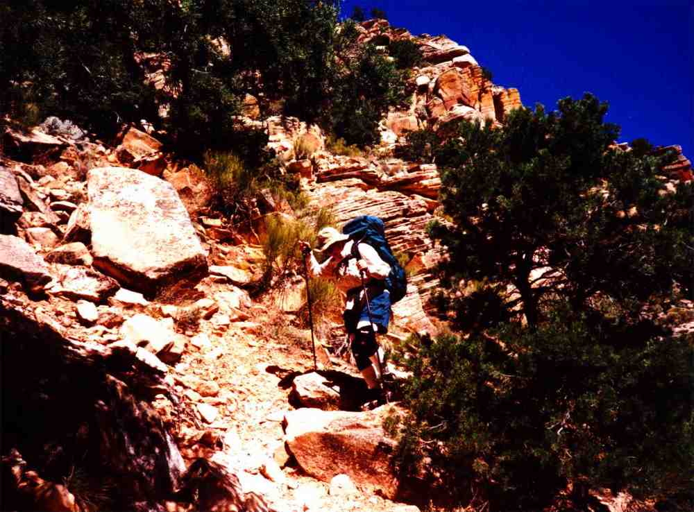
Day 2 (Monday) - The night had been cool but comfortable. We
were up at 5, boiled some eggs for breakfast, and started toward the Redwall at
7:45. We find the Redwall section of the Tanner Trail to be relatively easy, and
we were soon nearing the bottom after about 20-25 minutes. As I approached the
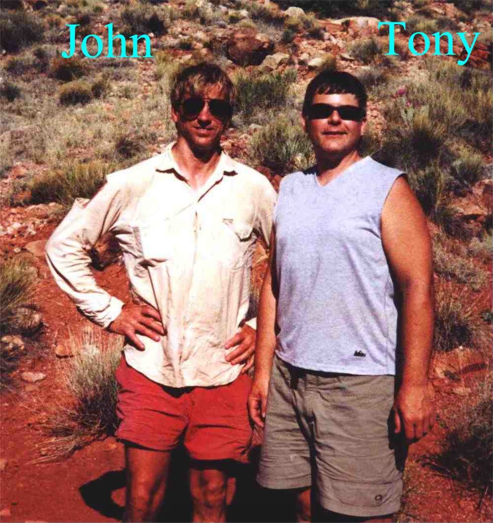
two campers we had spotted the night before, I was really surprised when one of them said
"Jim Lyons, I presume?". It was 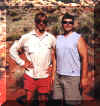 John Eyles, who I had messaged to a
few times on the Grand
Canyon Egroups message board but had never met, and his
friend Tony Stiglitz. I had previously told John that Kathy and I would be
hiking down that day, and he was expecting me. We chatted for a while, and then
started down through the Muav. With a couple of breaks to Moleskin our toes and
have some gorp, we reached Tanner Beach at 11:35, soaked our feet, and rested a
bit. Around 2, we had lunch of pilot crackers with peanut butter and a
couple of wheels of cheddar cheese. It was hot, so we spent the afternoon in the
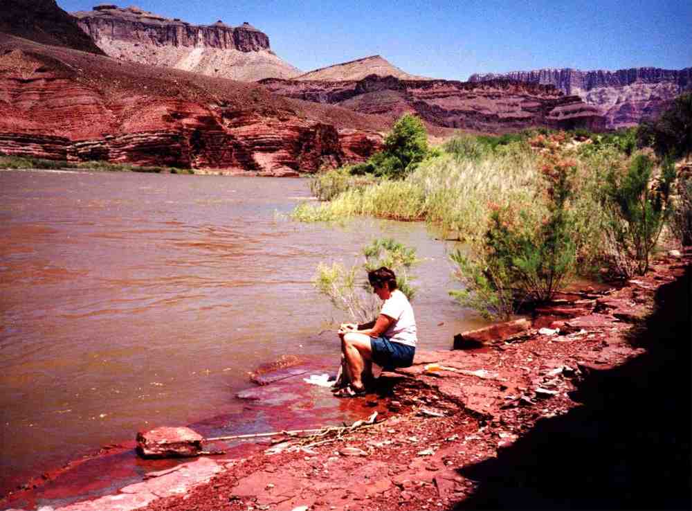
shade of a small tree. At 3:30, we set out for the Cardenas Creek area, and set up camp on a dune
just before the drainage. Headed down to the river, got wet to cool down, and
chilled a couple of Buds in the cool water of the Colorado River. It was too hot for
dinner so we just
snacked on jerky and gorp, and were in bed by 7:30. John Eyles, who I had messaged to a
few times on the Grand
Canyon Egroups message board but had never met, and his
friend Tony Stiglitz. I had previously told John that Kathy and I would be
hiking down that day, and he was expecting me. We chatted for a while, and then
started down through the Muav. With a couple of breaks to Moleskin our toes and
have some gorp, we reached Tanner Beach at 11:35, soaked our feet, and rested a
bit. Around 2, we had lunch of pilot crackers with peanut butter and a
couple of wheels of cheddar cheese. It was hot, so we spent the afternoon in the
shade of a small tree. At 3:30, we set out for the Cardenas Creek area, and set up camp on a dune
just before the drainage. Headed down to the river, got wet to cool down, and
chilled a couple of Buds in the cool water of the Colorado River. It was too hot for
dinner so we just
snacked on jerky and gorp, and were in bed by 7:30.
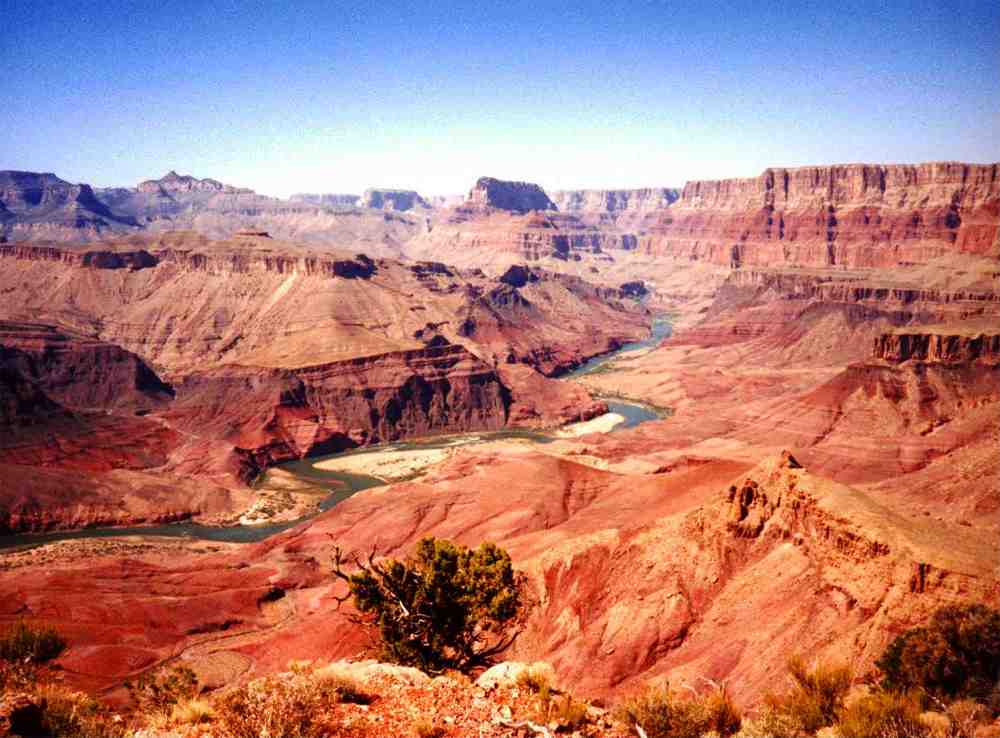
Day 3 (Tuesday) - Our original plan was to move our camp to
the Unkar Overlook this day to get a jump on our hike over to 75 Mile Beach.
Because of the heat, however, we decided to stay put for another night, and hang
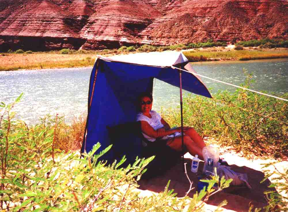
out by the river. We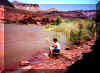 had a breakfast of fried eggs and hash browns with peppers
and bacon bits. The temperature, in the shade by the river, was 100F and we had
not expected this kind of heat so early in May. There is a section of ledges by
the river in this area had a breakfast of fried eggs and hash browns with peppers
and bacon bits. The temperature, in the shade by the river, was 100F and we had
not expected this kind of heat so early in May. There is a section of ledges by
the river in this area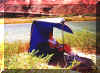 that has excellent shade until mid afternoon, and a nice
adjacent sandy beach area. When the sun finally hit us, we headed back up to our
camp,
set up a tarp for shade, and had a late lunch of noodles, corn and tortillas.
The sun set behind Vishnu at 6:30, and we had dinner of turkey with gravy,
potato and peas, and M&M's for dessert. We boiled our last two eggs for the
morning, and organized our equipment for the Escalante Route hike the following
day. that has excellent shade until mid afternoon, and a nice
adjacent sandy beach area. When the sun finally hit us, we headed back up to our
camp,
set up a tarp for shade, and had a late lunch of noodles, corn and tortillas.
The sun set behind Vishnu at 6:30, and we had dinner of turkey with gravy,
potato and peas, and M&M's for dessert. We boiled our last two eggs for the
morning, and organized our equipment for the Escalante Route hike the following
day.
 Day 4 (Wednesday) - Up at 3:40, we started over the Escalante Route
at 4:40, hiking in the dark using our headlamps to beat the heat of the sun. We were on
the Unkar Overlook at 5:15, and at the first drainage at 6:30 where we stopped
for a breakfast of boiled eggs, tortillas and jerky. Started hiking again at 7,
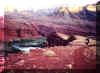
still in the shade, and reached Escalante Creek at 9:25 and the beach at 10:40.
We had elected to not try going over Day 4 (Wednesday) - Up at 3:40, we started over the Escalante Route
at 4:40, hiking in the dark using our headlamps to beat the heat of the sun. We were on
the Unkar Overlook at 5:15, and at the first drainage at 6:30 where we stopped
for a breakfast of boiled eggs, tortillas and jerky. Started hiking again at 7,
still in the shade, and reached Escalante Creek at 9:25 and the beach at 10:40.
We had elected to not try going over 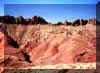 Butchart's Notch, and stuck to the longer contour
trail. Escalante Canyon is a bit deceiving. A couple of times we thought we were
almost at the river, but still had quite a ways to go. There are about 4
distinct drainages, and we had to keep climbing from one to the other toward the
west to avoid pouroffs blocking the way. On this route from east to west, the
first 70-80% of the hike is uphill, and the last 20-30% is downhill, with a
total elevation rise of about 1000 feet. The route is not challenging, but it
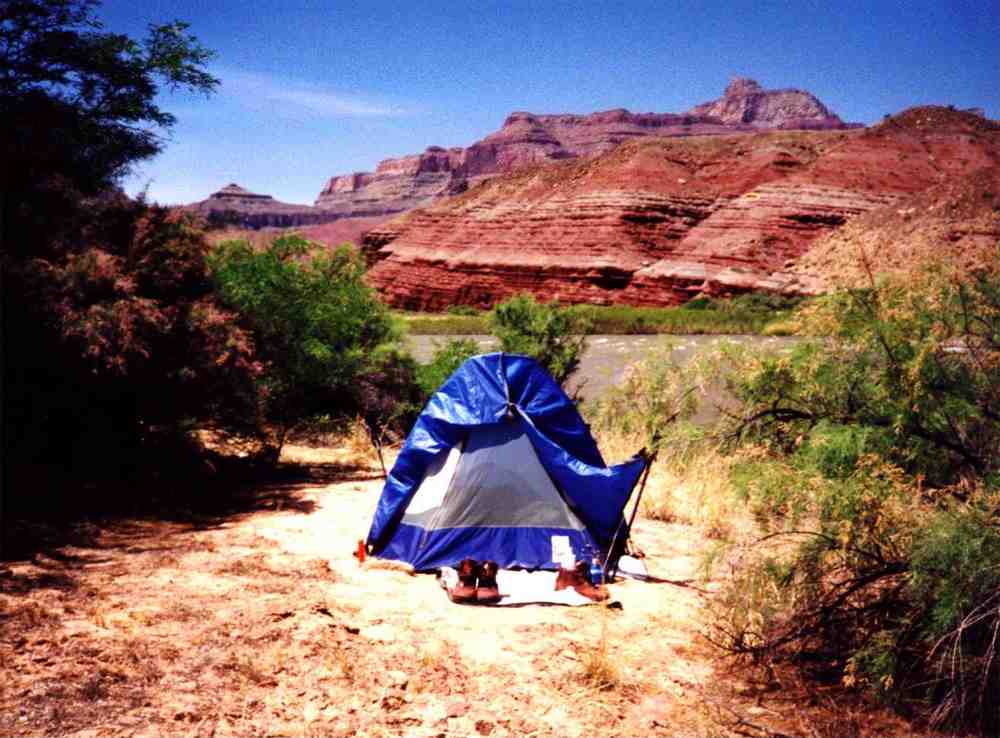
is about 9 miles long. There is a nice, partially shaded campsite near the river
on Escalante Beach where we set up our tent in the sand, and had a lunch of PB
and crackers, cheese and oatmeal bars. We set up a tarp on the beach for shade,
and hung around by the river. Around 4:55, the same time as the sun went behind
Solomon Temple, we had to take down the tarp because of the rising water level. We
finished off our two remaining Buds, and had dinner of macaroni and cheese. The
water, previously green and clear, started turning brown from the stirred up
silt, but not thick brown like when the Little Colorado River is running muddy.
This was a warm night for sleeping, and I woke up hourly to check that the still
rising water
was not threatening our tent.
Butchart's Notch, and stuck to the longer contour
trail. Escalante Canyon is a bit deceiving. A couple of times we thought we were
almost at the river, but still had quite a ways to go. There are about 4
distinct drainages, and we had to keep climbing from one to the other toward the
west to avoid pouroffs blocking the way. On this route from east to west, the
first 70-80% of the hike is uphill, and the last 20-30% is downhill, with a
total elevation rise of about 1000 feet. The route is not challenging, but it
is about 9 miles long. There is a nice, partially shaded campsite near the river
on Escalante Beach where we set up our tent in the sand, and had a lunch of PB
and crackers, cheese and oatmeal bars. We set up a tarp on the beach for shade,
and hung around by the river. Around 4:55, the same time as the sun went behind
Solomon Temple, we had to take down the tarp because of the rising water level. We
finished off our two remaining Buds, and had dinner of macaroni and cheese. The
water, previously green and clear, started turning brown from the stirred up
silt, but not thick brown like when the Little Colorado River is running muddy.
This was a warm night for sleeping, and I woke up hourly to check that the still
rising water
was not threatening our tent.
Day 5 (Thursday) - The water had risen during the night
to about 3+ vertical feet higher than it had been the day before. There was a
constant procession of floating branches and logs coming by that had floated off
the shoreline upriver. We got up at 5:45, had some oatmeal, and started a day
hike to 75 Mile Beach at 6:55, arriving at 7:45. We took a shortcut to the creek
bed down the jumbled side of a cliff about 60-80 feet high, and that short rock
climb probably saved half a mile of hiking. The site at 75 Mile where we had
camped the year before was partially flooded, and the beautiful crescent beach
was under water. We were glad that we had decided to camp at Escalante and day
hike to 75 Mile instead of backpacking over. On the way back, Kathy found a
weathered quarter at the base of the rock climb. Hard to imagine anyone actually
carrying change into the canyon, but Kathy put it into her pocket and carried it
out. We watched a motorized raft go through Nevill's Rapids from a high vantage
point on the trail, and continued on back to Escalante where we found a shady
spot up in the canyon for the afternoon. As we were making our lunch of turkey
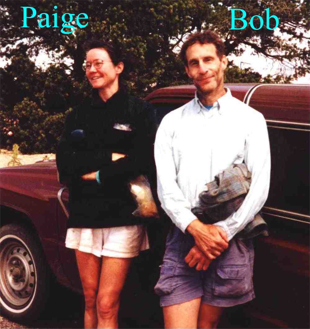
salad tortillas, two hikers entered the drainage from the west. This was Bob and
Paige from Oregon, who we would run into several times more on our trip. Bob's
Pur filter had broken, so I pumped some water with my Sweetwater, filled up his containers, and gave him a couple of packets of Emergen-C to
recharge his electrolytes. Our planned dinner of chicken and gravy over rice
with stuffing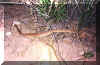 turned into chicken and rice soup with stuffing, but it was still
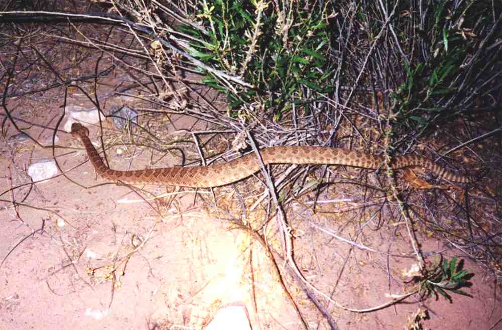
very good. Just after dark, Kathy started walking to the river. As she stepped over what she thought was a stick, she was startled when it hissed,
rattled and coiled. The young rattlesnake resumed its hunt when Kathy jumped
back, and it was quite agreeable to having its picture taken. This was our
second rattlesnake encounter in the Canyon, the first being at the Little
Colorado River a couple of years earlier. Today had been
another cloudless and hot day. turned into chicken and rice soup with stuffing, but it was still
very good. Just after dark, Kathy started walking to the river. As she stepped over what she thought was a stick, she was startled when it hissed,
rattled and coiled. The young rattlesnake resumed its hunt when Kathy jumped
back, and it was quite agreeable to having its picture taken. This was our
second rattlesnake encounter in the Canyon, the first being at the Little
Colorado River a couple of years earlier. Today had been
another cloudless and hot day.
Day 6 (Friday) - Up at 3:40, we were packed and on the trail at
4:20, again using headlamps in the dark. We reached the exit point out of
Escalante Creek at 5:42 and stopped at 8 for a breakfast of Muslix with milk and coffee. We found the trail back much easier, getting all of the climbing out of
the way at the beginning, and having a gradual decline for the balance of the
trip back to Cardenas Creek. We stopped at the river trip campsites at Cardenas to cool
off, and found several rafts marked GCMRC (Grand Canyon Monitoring and Research Center) beached there, with some scientists studying birds in the area. Having a preference for
the beach sites
which were already taken by the boating group, we continued on the 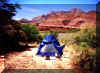 the other side of the
drainage
and found a great, out of the way, site down by the river that appeared to have
not been used in years. Some clouds moved in, the temperature dropped to 85 and
the wind started blowing sand. It seems that we always have one sandstorm on
each of our trips to the canyon. The fine sand goes right through the screens of
the tent, and gets into everything. When it is over, we simply lift one side of
the tent and empty the sand out. After a dinner of beef and gravy, potato and
corn, the wind died down, and we had a nice cool night for sleeping. the other side of the
drainage
and found a great, out of the way, site down by the river that appeared to have
not been used in years. Some clouds moved in, the temperature dropped to 85 and
the wind started blowing sand. It seems that we always have one sandstorm on
each of our trips to the canyon. The fine sand goes right through the screens of
the tent, and gets into everything. When it is over, we simply lift one side of
the tent and empty the sand out. After a dinner of beef and gravy, potato and
corn, the wind died down, and we had a nice cool night for sleeping.
Day 7 (Saturday) - This was a rest day before our hike out. Up
at 6:30, the temperature was a pleasant 68 degrees, and rose to 75 degrees by
8:30 with clouds partially blocking the sun. We washed our clothes and ourselves, and
used our 6 liter platypus bag as a shower with sun warmed water. Up to this
point, we had seen only a couple of rafting trips each day. This afternoon,
however, 5 trips came through between 4 and 5 o'clock. With most of the beaches
flooded out by the high water, we wondered where they would camp for the night.
We never left the campsite all day, just hanging around watching the river go
by. Dinner consisted of chicken and gravy, potato and peas, with oatmeal bars
for dessert.
Day 8 (Sunday) - Up at 3:30, we were packed and on the trail by
4:15. It took just about an hour to reach Tanner Beach. The water was still
high, and came up into the Tanner drainage about 10-15 feet, flooding one
campsite under the big rock on the upriver side of the drainage. Stopping along
the way for oatmeal and coffee, we reached the 75 Mile Saddle at noon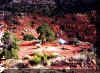 where we
set up camp. Along the way, we saw Bob and Paige at the top of the Redwall, and
again at 75 Mile Saddle, where they also camped a short distance away. The wind
was gusting quite strongly out of 75 Mile Canyon, but our Clip Flashlight tent
handles the wind very well, and it posed no problem. Finishing our dinner of
macaroni and tomato sauce, Kathy and I watched the sun set over Escalante Butte
on our last night in the canyon. where we
set up camp. Along the way, we saw Bob and Paige at the top of the Redwall, and
again at 75 Mile Saddle, where they also camped a short distance away. The wind
was gusting quite strongly out of 75 Mile Canyon, but our Clip Flashlight tent
handles the wind very well, and it posed no problem. Finishing our dinner of
macaroni and tomato sauce, Kathy and I watched the sun set over Escalante Butte
on our last night in the canyon.
Day 9 (Monday) - After an oatmeal breakfast, we were on the
trail at 8:00. The weather was cool, Tanner Canyon still shaded, and just a
perfect day for hiking. We reached Lipan Point in two hours, went to our car,
and cleaned up with our  remaining water. We met up with Bob and Paige for the
last time, said our goodbyes, and then we headed to Cameron for lunch, and then on to
our motel in Flagstaff. With this trip, we had completed our last remaining
un-hiked section between the Little Colorado River and Horseshoe Mesa. We will
probably not hike the Tanner again, but start working our way from Horseshoe
Mesa toward the west, or possibly do the South/North Kaibab rim-to-rim as our
next hike. remaining water. We met up with Bob and Paige for the
last time, said our goodbyes, and then we headed to Cameron for lunch, and then on to
our motel in Flagstaff. With this trip, we had completed our last remaining
un-hiked section between the Little Colorado River and Horseshoe Mesa. We will
probably not hike the Tanner again, but start working our way from Horseshoe
Mesa toward the west, or possibly do the South/North Kaibab rim-to-rim as our
next hike.
|